
Aug. 26: Bear UPDATE: Fire burning in heavy fuels; evac advisory in effect
UPDATE 8:15 p.m.: Crews continued to build a defensive line along Slate Creek Spur on the north side of the fire in an effort to catch any threat of it moving north toward Quincy, as well as build indirect line on the west side of the fire. The fire remains active and is backing through significant fuels in an area that has little to no fire history.
UPDATE 2:30 p.m.: Increased activity is reported on the west side of the fire, particularly in areas of dense forest fuels. Crews are working west of the area to build defensive dozer line to catch the fire. Crews were also working to build and reinforce dozer line to the north.
The Bear Fire is 4,901 acres and 0 percent contained.
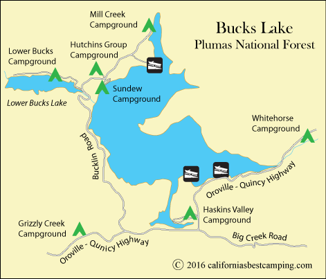
An evacuation advisory has been issued for Bucks Lake, south of Bucks Lake Lodge to include Big Creek Road from Bucklin Road to China Gulch and south of Big Creek Road to Mount Ararat. Please prepare to evacuate. If you have special needs you are encouraged to evacuate now and if you have large animals make arrangement to move them immediately.
Today, crews will continue to strengthen a defensive line along Slate Creek Spur on the north side of the fire in an effort to catch any threat of it moving north toward Quincy. They will also work to keep the fire from moving east where it crossed Little Bear Creek. The fire is currently held north of the Middle Fork of the Feather River.
The Bear Fire is located on the Pacific Crest Trail, 1-mile northwest of Butte Bar Campground and 1.5 southeast of Lookout Rock. The Pacific Crest Trail from Onion Valley to Bucks Summit remains closed. It broke out Aug. 17 following a lightning strike.